|
|
Aconcagua
Maps
of
Aconcagua
&
Mendoza
Below
are
maps
of
Aconcagua
and
Mendoza,
click
the
maps
to
enlarge
(new
window).
See
also
the
detailed
routes
page.
|
|
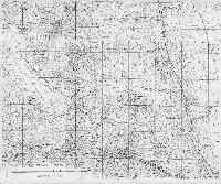
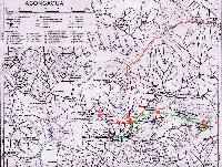
There
are
no
good
maps
available
of
Mt
Aconcagua.
There
are
4
different
military
maps,
that
-combined-
give
quite
a
good
picture
(but
as
you
can
see
the
contour
lines
don't
connect
on
the
different
parts).
The
intersection
of
the
maps
is
just
besides
the
summit,
so
depending
on
the
route
you
might
need
to
buy
2,
3
or
4
of
these
maps...
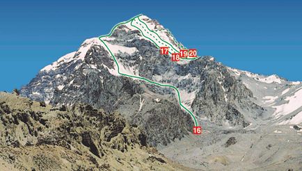
The
Falso
de
los
Polacos
route
is
marked,
the
normal
route
can
be
found
easily
as
well.
Click
to
enlarge
(330k)
Thanks
to
Kelly
for
supplying
these
maps
|
|
|
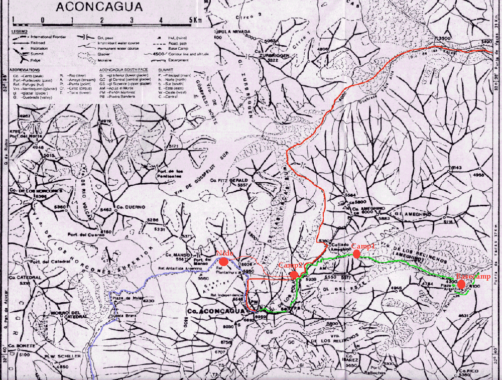
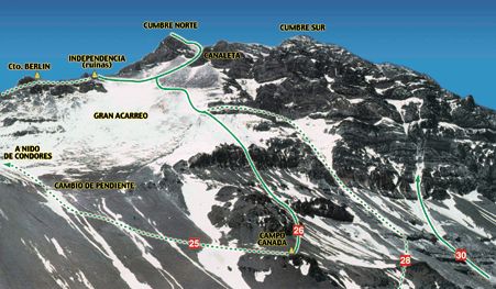
This
map
only
shows
the
major
ridges
and
the
last
parts
of
the
major
routes;
click
to
enlarge
(410k).
- Green
route:
Polish
Glacier
- Red
route:
Falso
de
los
Polacos
/
traverse
route
via
alternative
approach
(end
of
Vacas
valley)
- Blue
route:
Normal
route.
|
|
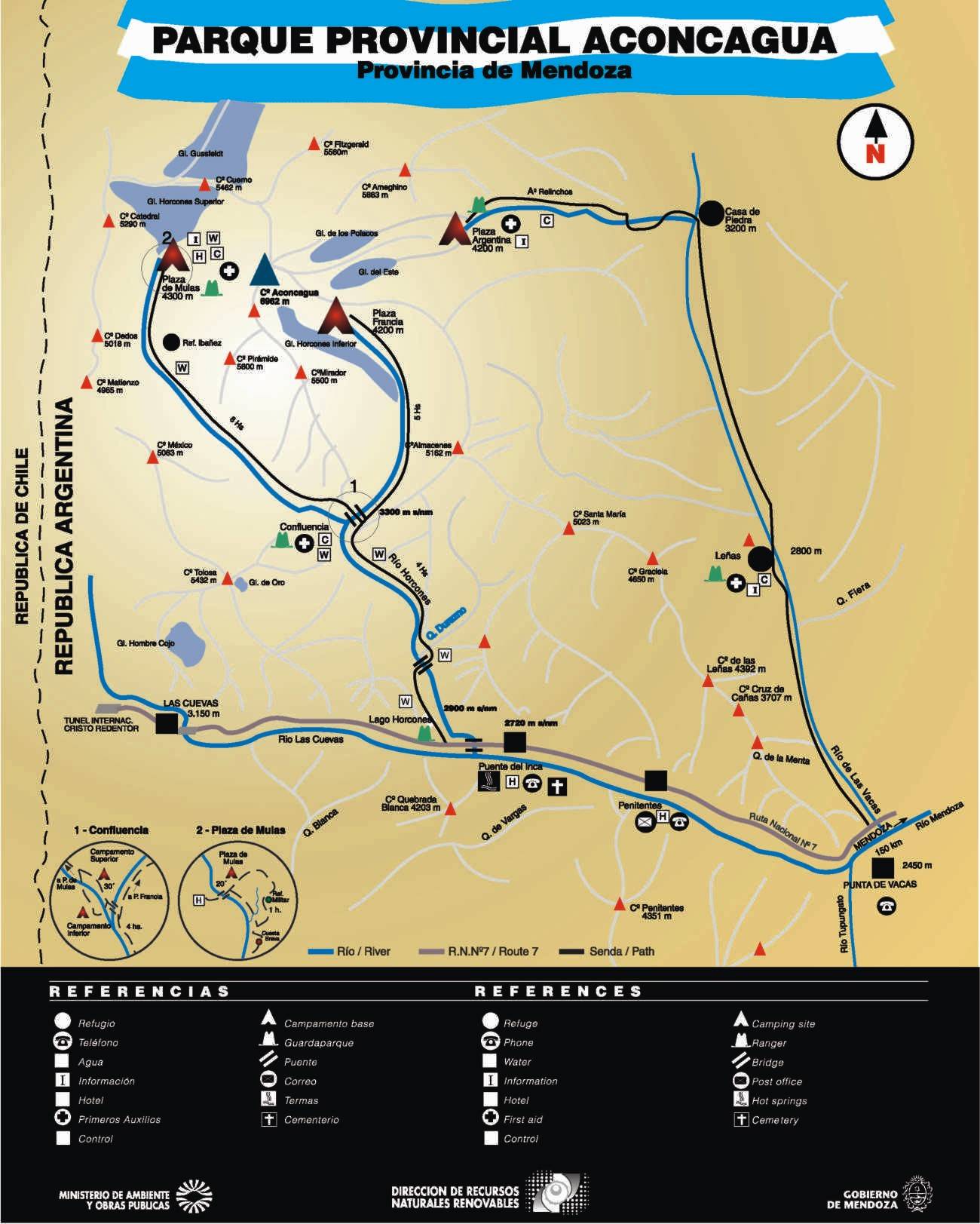
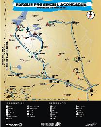
This
schematic
map
is
issued
at
the
permit
office
and
shows
the
different
routes,
basecampsites
and
the
services
in
the
area
(214kb)
|
|
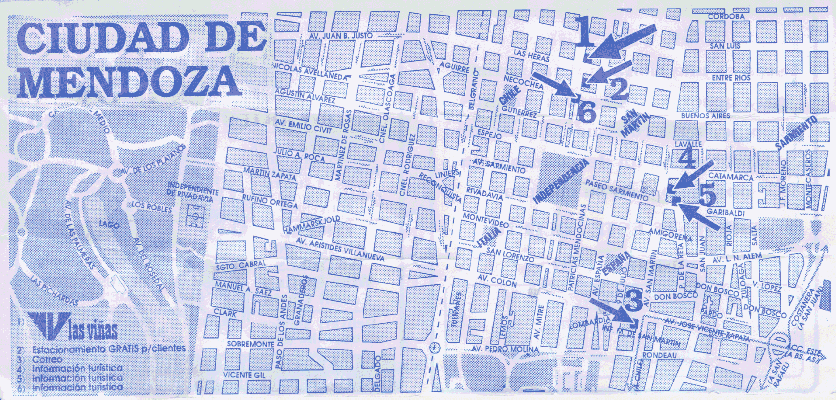
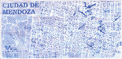
This
is
the
map
of
Mendoza
City
centre.
The
street
numbers
initiate
at
zero
around
the
intersection
of
Avenida
San
Martin
and
Hipolito
Irigoyen
(off
the
bottom
of
the
page,
about
five
blocks
south
of
the
number
3).
IMPORTANT:
Permits
to
access
the
park's
premises
are
now only
issued
at
Dirección
de
Recursos
Naturales
Renovables,
(located
in
Parque
San
Martín).
Now
you
cannot
go
to
the
official
permit
office
(or
'subsecretario
de
Turismo'),
located
on
the
main
street
Av.
San
Martin anymore. |
Routemaps:
|
|
|
|
|
Click
the
images
to
go
to
the
detailed
routes
page
|
|