








The Thredbo chairlift
The Kosciuszko Express chairlift lifts you 560 m to about 1,930 m and turns the summit into an easy day-walk. How it works, roughly what it costs, and how summer and winter differ.
The single thing that makes Kosciuszko the easiest of the 7 summits is a chairlift. The Kosciuszko Express at Thredbo carries you from the village up to the start of the summit walkway, taking most of the climb out of the day. You do not have to use it (you can walk up from the valley) but almost everyone does, and it is what turns the summit into a comfortable few hours' walk.
What it does
The Kosciuszko Express rises about 560 vertical metres from Thredbo village to the top station at roughly 1,930 m6,332 ft, near the Eagles Nest restaurant, in around 15 minutes. From the top the raised walkway to the summit begins. That lift saves you the steepest, dullest part of the climb and drops you straight into the high alpine country, which is exactly why the Thredbo route is the one most people walk.
Nothing is loaded from YouTube until you press play.
A time-lapse ride down the chairlift, the full 1.8km descent from top station to base compressed into thirty seconds, giving a clear sense of the terrain it covers.
Summer and winter
The chairlift runs year-round but for two different worlds. In summer it is a scenic lift for walkers and sightseers heading up to the Eagles Nest and the summit track. In winter it is part of the Thredbo ski resort, carrying skiers and snowboarders, and the walkway above it is under snow, so a winter "walk" from the top is really a ski-tour or snowshoe trip. Operating hours are shorter and weather-dependent in both seasons, and the lift can close in high wind, so check the day's running times and plan your walk to be back before the last chair down.
What it costs
The chairlift is run by Thredbo, not the national park, and you pay the resort for a lift ticket separately from the NPWS park pass. Prices vary by season and change year to year, so treat any figure you see as a rough guide and check the current Thredbo rate, a scenic summer sightseer ticket is normally much cheaper than a winter lift pass. Summer access is now sold as a minimum one-day lift pass covering both the Kosciuszko Express and the Merritts Gondola, rather than cheaper one-way or return fares; one recent visitor reported paying $55 per adult for that pass, plus $17 to bring a car into Thredbo. Some walkers still ride up and walk all the way down.
Maps & profiles
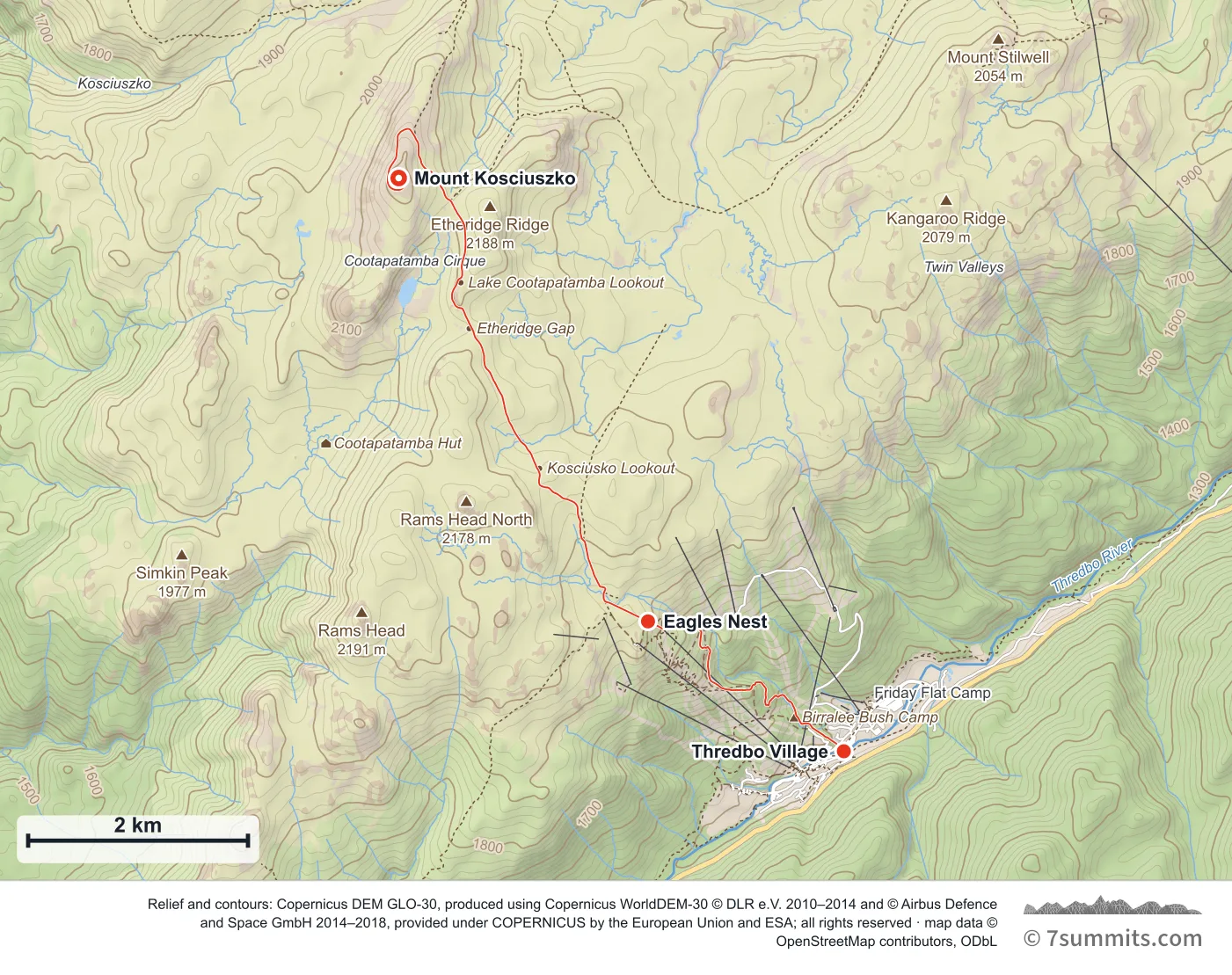
Point at the route or drag along the profile to see the height and the distance walked.
GPX files
Download the Merritts Nature Track
Navigation aid only, not a substitute for your own judgement, current conditions or local knowledge. Elevations are modelled from open terrain data, not surveyed.
Sources, credits and licence
© OpenStreetMap contributors + OSM public GPS traces. Licence: ODbL 1.0. Source data
Waypoints
WGS84 decimal degrees. Elevations are modelled from open terrain data (roughly 20–50 m low on snow and ice), not published camp altitudes: read them as approximate positions, not pitches.
| Waypoint | Latitude | Longitude | m | ft |
|---|---|---|---|---|
| Thredbo Village (4,478 ft) | -36.50269 | 148.30875 | 1,365 | 4,478 |
| Eagles Nest (6,355 ft) | -36.49207 | 148.28885 | 1,937 | 6,355 |
| Mount Kosciuszko (7,310 ft) | -36.45583 | 148.26351 | 2,228 | 7,310 |
Links to other people’s recordings, hosted by them. Compare and cross-check: never assume any single line is safe.