








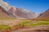

The Normal Route, the Polish Traverse and the Polish Glacier compared: which valley, which base camp, and which route suits which climber.
A major decision is which approach route to use. This guide covers the Normal Route (Horcones Valley) and the Polish Traverse and Polish Glacier (Vacas Valley). The access valleys are named after the rivers that created them.
| Route | Approach valley | Base camp | Comments |
|---|---|---|---|
| Normal Route | Horcones | Plaza de Mulas | Non-technical; chosen by over 75% of climbers for ascent and descent; also used for descent by some Polish Traverse climbers |
| Polish Traverse | Vacas | Plaza Argentina | Non-technical; goes around the Polish Glacier, traversing to join the upper part of the Normal Route |
| Polish Glacier (Original & Direct) | Vacas | Plaza Argentina | Technical glacier ascent; demands experience of ice climbing and glacier travel |
The Normal Route
The Horcones Valley gives access to the Normal Route and to technical South Face routes (not covered in this guide). The majority of climbers (over 75%) use the Normal Route as it presents no technical difficulties. Plaza de Mulas is a busy tented base camp, where the companies run mess tents, meals, showers and internet for their clients; the old Hotel Refugio Plaza de Mulas there closed around 2013 and is used by the park’s rescue patrol. The Normal Route tempts people to ascend to base camp too fast, causing severe altitude problems for the unwary, and it can be very crowded.
The Vacas Valley routes
The Vacas Valley gives access to the Polish Glacier routes, the Polish Traverse route (or ‘Falso de los Polacos’), and the Guanacos Route (also not covered in this guide). All Vacas Valley routes are identical as far as Casa de Piedra (3200 m10,499 ft), where the ‘Polish’ routes (Traverse and Glacier) turn west and remain the same up to 5900 m19,357 ft. At this point, the Glacier routes ascend the glacier, whereas the Traverse route goes round it, making a traverse to join the upper part of the Normal Route.
Nothing is loaded from YouTube until you press play.
A short narrated aerial flyover of the Polish Traverse route, showing how it threads around the mountain compared with the Normal Route below.
The Polish Traverse route is therefore non-technical like the Normal Route, but it contains a few more snow fields and takes three days to reach base camp. Some groups ascending on this route descend via the Normal Route instead, making a full traverse of the mountain, this needs extra effort, since you must carry all of your extra gear and trash over 6000 m19,685 ft.
The Polish Glacier routes are technical, involving a long, icy glacier ascent. There are many potential lines up the glacier, all requiring experience of glacier travel and full ice-climbing gear. The average slope is about 35°, with sections as steep as 50–70° depending on conditions. The main choice is between the Original route, established in 1934, and the Direct, which runs over steeper but safer ice and snow. Neither is climbed very often, because they are viable only when the snow and ice are in good condition: most of the time either there isn’t enough snow, exposing hard ice, or there’s too much, making it impassable. If you were planning a glacier route but conditions look wrong from high camp, you can still switch to a Traverse route instead.
Which route suits you?
The Polish Glacier routes, then, are suitable only for experienced technical ice climbers. For most people, the real choice is between the Normal Route and the Polish Traverse. If you are completely inexperienced in the mountains, Aconcagua (on any route) is not a good place to learn.
Choose the Normal Route if you
- like company and the busier, better-served base camp
- are relatively inexperienced in high mountains, scrambling and the use of crampons
- are already fully acclimatized and want a quick ascent
Choose the Polish Traverse route if you
- want a rougher trek: more rocks, harder tracks, more snow and ice, more variation, longer distance and fewer people
- are experienced enough to handle these challenges
- want any chance of seeing wildlife such as guanacos
Maps & profiles
Image credits: © The original uploader was Radu.vatcu at Romanian Wikipedia . · CC BY 2.5 · Wikimedia Commons · modified