








The South (Normal) route
The standard Elbrus: up the Baksan valley from Azau, cable car and chairlift to the Barrels huts, acclimatize to the Pastukhov Rocks, and summit day across the saddle to the West top.
This is the route almost everyone climbs, and the one to do first. It goes up the south side of the mountain from the village of Azau at the head of the Baksan valley, the developed, lift-served side, where a cable car and chairlift carry you and your gear to huts on the glacier at about 3,800 m12,467 ft, and a snowcat can drop you high on summit morning if you choose to pay for it.
From the huts you acclimatize with a climb up towards the Pastukhov Rocks, and on summit day you cross below the East summit to the saddle and up the final slope to the West summit at 5,642 m18,510 ft, the true top of Elbrus and of Europe.
The infrastructure is what makes this route so much faster than the north: a proper trip runs about eight days rather than ten or eleven. The trade is crowds and a ski-resort feel low down, and the temptation (dangerous on a mountain this high) to gain height faster than you should.
A good south-side itinerary does not go straight up. It starts with a couple of days of valley acclimatization walks before you even move to the huts, then builds height in stages. The pages below follow that order: valley acclimatization, up to the Barrels, an acclimatization climb to the Pastukhov Rocks, and summit day.
In this section
Maps & profiles
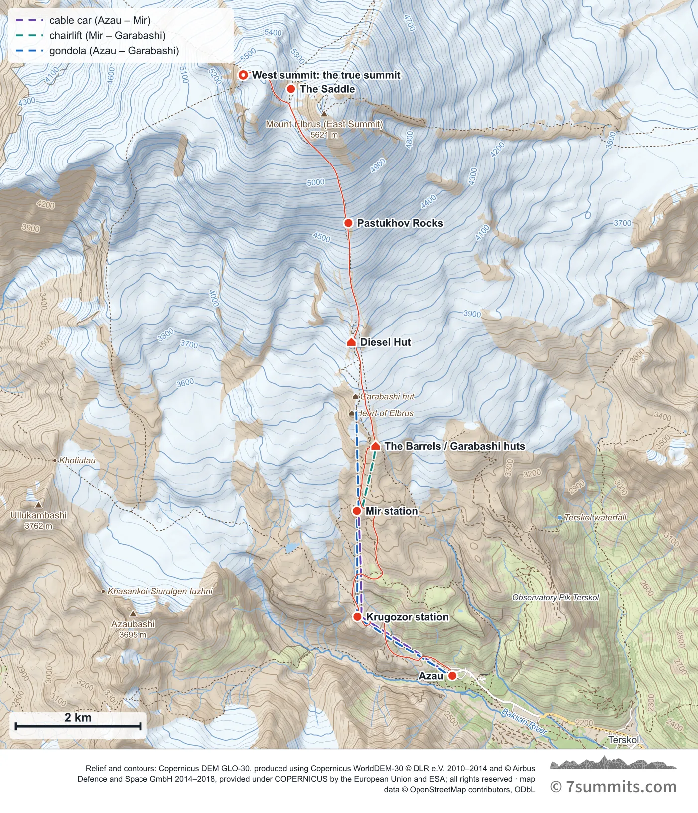
Point at the route or drag along the profile to see the height and the distance walked.
GPX files
Download the South (Normal) route track
Navigation aid only, not a substitute for your own judgement, current conditions or local knowledge. Elevations are modelled from open terrain data, not surveyed.
Sources, credits and licence
© OpenStreetMap contributors (ODbL). Licence: See source. Source data
Waypoints
WGS84 decimal degrees. Elevations are modelled from open terrain data (roughly 20–50 m low on snow and ice), not published camp altitudes: read them as approximate positions, not pitches.
| Waypoint | Latitude | Longitude | m | ft |
|---|---|---|---|---|
| Azau (2,350 m) | 43.26577 | 42.47930 | 2,350 | 7,710 |
| Krugozor station (3,000 m) | 43.27433 | 42.46046 | 3,000 | 9,843 |
| Mir station (3,500 m) | 43.28954 | 42.46035 | 3,500 | 11,483 |
| The Barrels / Garabashi huts (3,710 m) | 43.29894 | 42.46406 | 3,710 | 12,172 |
| Diesel Hut (4,050 m) | 43.31390 | 42.45927 | 4,050 | 13,287 |
| Pastukhov Rocks (4,650 m) | 43.33107 | 42.45868 | 4,650 | 15,256 |
| The Saddle (5,373 m) | 43.35041 | 42.44731 | 5,373 | 17,628 |
| West summit: the true summit (5,642 m) | 43.35241 | 42.43784 | 5,642 | 18,510 |
Links to other people’s recordings, hosted by them. Compare and cross-check: never assume any single line is safe.