








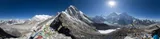

Four to five trekking days from Tengboche through Pheriche or Dingboche, Lobuche and Gorak Shep to Base Camp at 5,360 m, with rest days for the altitude.
| Time | 4–5 trekking days of 3–5 hours each, plus rest days for acclimatization |
| Altitude gained | about 1500 m4,921 ft: Tengboche 3860 m12,664 ft → Pheriche 4275 m14,026 ft or Dingboche 4360 m14,304 ft → Lobuche 4930 m16,175 ft → Gorak Shep 5140 m16,864 ft → Base Camp 5360 m17,585 ft |
| Terrain | easy trails at ever-increasing altitude, with lodges at every overnight stop |
| Summary | the walking is simple but the altitude is serious: build in rest days and watch everyone in the team for AMS symptoms |
Tengboche to Pheriche or Dingboche
Continue through the forest and enjoy the fresh scents of the vegetation, your last chance for several weeks. After crossing the river to its north bank you climb to reach Pangboche (3950 m12,959 ft) within about 2–3 hours of Tengboche. It’s a good place to rest and take some milk tea.
Cross a small river and continue another hour until you reach Tsuo Og, which has just a few houses. The route divides here: left for Pheriche (4275 m14,026 ft) or right to Dingboche (4360 m14,304 ft). If you keep going on the left of the river (crossing it 1 km ahead) you will arrive in Pheriche about 2 hours after leaving Pangboche. Alternatively, cross the river and head uphill towards Dingboche, a larger village in a side valley leading toward Island Peak and Lhotse.
You could stay two nights in Dingboche and hike up the valley on the day between, or climb Chukhung Ri (5500 m18,045 ft), really just a point on a ridge south of Nuptse but a rewarding acclimatization hike: head north-east out of Dingboche to the settlement of Chukhung, 200 m656 ft higher and less than an hour away, then follow the easy tracks north and north-east all the way to the top. It can be chilly up there, so come prepared and carry plenty of water; the views of Ama Dablam and Lhotse are superb, and you will be back in Dingboche before dinner.
Pheriche or Dingboche to Lobuche (3–5 hours)
Leaving Pheriche, follow the valley trail for 1.5 km until it branches up, slightly to the right. Continue until you cross a small bridge leading into Dughla (4620 m15,157 ft), a perfect place for refreshment after 1–2 hours of hiking. The hike from Dingboche takes about the same time: head west, climb the sandy track up the short steep hill and head down the other side. From there you walk parallel to the Pheriche variant, but 150 m492 ft higher, looking over fields with great views of Cholatse and Taboche peaks on the other side of the valley.
From Dughla you head uphill for an hour over a tough rocky moraine path, gaining 200 m656 ft until you reach a small pass and plateau. This is the end of the Khumbu Glacier, and all the piles of rocks you see in front of you are memorials for sherpas who died on Everest, a sombre reminder of their hard work and the dangers they face, all to assist affluent tourists.
A few hundred metres after this pass you may notice a track leading left and up. This is a great variation for the return journey and a classic trek in itself: via Dzonghla and over the Cho La pass (5368 m17,612 ft), then down into the Gokyo valley, leading back to Namche. It is a tough trek and sees much less traffic.
For now, keep going along a trail that’s usually muddy, until you reach the collection of lodges known as Lobuche (4930 m16,175 ft). It’s a desolate and windy place with few diversions, although you can visit the Italian Pyramid research centre up the road, scramble up the glacier or climb the hills around the village. Then you can settle in front of a yak-dung-powered stove with a big bowl of soup, always remember to stay hydrated. Climbers who slept in Pheriche tend to have more AMS trouble here than those who chose the higher Dingboche: one more reason for that side-valley detour.
Lobuche to Gorak Shep (2–3 hours)
Continue along the north-west side of the Khumbu Glacier. If the sky is clear you will see the shape of Pumori looming in front of you. Climb any of the tracks up towards the U-shaped Lobuche Pass (5110 m16,765 ft) and continue over a crossing of three glaciers until you reach Gorak Shep (5140 m16,864 ft), a series of guesthouses. Like Lobuche, this settlement is here just to service the trekkers and climbers.
Most trekkers stay 1 or 2 nights in Gorak Shep, making two excursions from there: a visit to BC and a climb up Kala Pattar. As you will spend plenty of time in BC anyway, you may want to focus on Kala Pattar. If you arrive early enough, it can be climbed the same day, although the view is often obscured in the afternoons. The hike is about a 3-hour round trip; the summit is really just an accessible part of Pumori’s south ridge, at 5545 m18,192 ft. Hike across the old lake, now a valley, and up the other side on sandy switchbacks. Continue upwards by going north and carefully scramble up the final exposed section. The main attraction is the view from the prayer-flag-covered top, the best view of Everest’s summit you can get without climbing a serious mountain. (Surprisingly, the summit cannot be seen from Base Camp itself.)
Gorak Shep to Base Camp (3–4 hours)
The section from Gorak Shep to Base Camp is strenuous in both directions. If you are just visiting BC as part of a trek, leave early, because the hike down takes almost as long as uphill. The track meanders beside and then across the Khumbu Glacier. It appears closer than it is, due to all the Himalayan giants around you confusing your sense of scale.
The trail to Base Camp crosses glacial moraine and frozen meltwater pools like this one.
Base Camp is located at the snout of the infamous Khumbu Icefall. Although not as jumbled as the Icefall, the BC area isn’t very flat. Over the years, many good camping spots have been developed, and once the spring snow has melted it can be warm and pleasant here.
Maps & profiles
Image credits: © Thomas Fuhrmann · CC BY-SA 3.0 · Wikimedia Commons · modified