








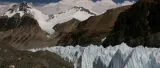

From Intermediate Camp at 5,800 m past Changtse Camp to Advanced Base Camp at 6,400 m: a straightforward hike with icy sections, made long by the altitude.
| Altitude gained | 600 m1,969 ft: IC 5800 m19,029 ft → Changtse Camp 6050 m19,849 ft → ABC 6400 m20,997 ft |
| Time (up) | first time 6–8 hours, thereafter 3–5 hours |
| Time (down) | first time 4–5 hours, thereafter 2–3 hours |
| Summary | a straightforward hike with some icy, slippery sections, but altitude will make the last part seem endless |
From both IC locations, the start is tough because you have to climb to the very top of the central moraine. Afterwards, the route is quite gradual and easy to follow: just stay on top for about 3 km, walking almost due south-south-east on the rocky moraine between the icy glaciers.
Near the end of this section, the track moves to the left (east) side of the moraine and down a little until you are level with the ice. Cross a small river (usually frozen) and after climbing a few metres back up again, the area opens up. This entire section can be very slippery due to unexpected bare blue ice, so take great care.
The open area is sometimes referred to as Changtse Camp: you can ascend Everest’s smaller cousin Changtse (7543 m24,747 ft) from here, where the Changtse Glacier (to your right) merges with the East Rongbuk. This is halfway to ABC in horizontal distance, but a little less than that vertically. There are many good places to have lunch if it is not too windy, and you may find some yak-herders selling soft drinks.
Continue straight along the clear track south-easterly, passing a huge ice-slab coming down from Changtse. Depending on the season, you may have to cross or go around some small lakes. The smaller hills may be icy, although crampons aren’t needed. Usually there’s one big crack in the glacier which must be circumnavigated by going down and around its left (eastern) side. Like Changtse Camp, this area will also be wet at the end of the season, with many small lakes and ponds affecting the route.
Basically you have to go all the way around Changtse. As soon as you seem to head straight into the ice-sharks and Everest appears again, the track makes another 90° turn to the south-west. It isn’t much further, but you still have to ascend about 200 m656 ft, so it will feel very tough, especially the first time. Once you are in Changtse’s shadow, the temperature can drop like a stone, so carry your warm clothes and aim to arrive before 17:00. Even though ABC is close, protect yourself from hypothermia, frostbite and AMS, and keep well hydrated.
Soon you will see the first tents, many of them belonging to climbers who have come to climb Lhakpa Ri, the 7045 m (23,114 ft)23,114 ft mountain to your left. Everest ABC is still a bit further and higher. If you are unguided, make sure you know how to recognize your team’s camp, as it can take an hour from the beginning of ABC to the highest tents. When you are tired and AMS-prone, the last thing you need is to waste time looking for your kitchen tent.
ABC is a big place, and the best spots will have been taken by the large operators. If you are going to make your own camp, don’t be tempted to camp too close to Changtse: although it’s sheltered, there’s a lot of rockfall from the mountain.