Home › Kilimanjaro › Kilimanjaro map
Kilimanjaro map Where Kilimanjaro is, and each route we map on it with the camps marked. Every map opens larger, and each group links to the chapter that describes the route.
Where Kilimanjaro is Where on Earth: Kilimanjaro, one of the 7 summits. · Imagery: NASA Earth Observatory “Blue Marble” · borders: Natural Earth (public domain) Kilimanjaro: Overview Kilimanjaro within Africa. · Imagery: NASA Earth Observatory “Blue Marble” · borders: Natural Earth (public domain) All six routes on one map. Machame, Lemosho, Umbwe and the Northern Circuit come down the south side by the Mweka trail; Marangu (↕) goes up and down the same trail, and Rongai comes down it. Navigation aid only, not for wayfinding. · © MapTiler © OpenStreetMap contributors Read the chapter: Kilimanjaro: Overview
The Machame route Point at the route or drag along the profile to see the height and the distance walked.
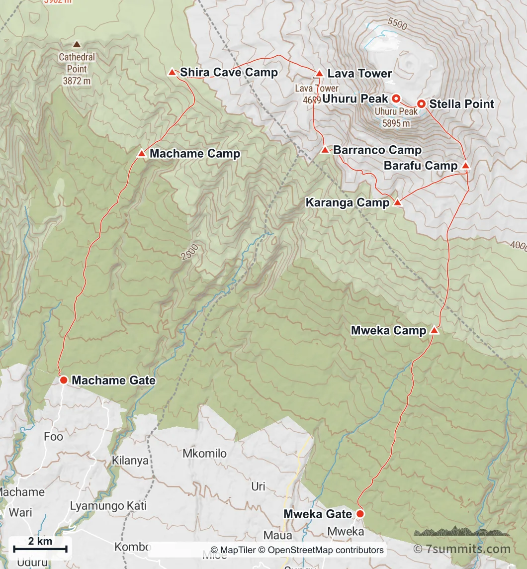
The Machame Route from Machame Gate to Uhuru Peak, descending by the Mweka route. Every camp is marked. Navigation aid only, not for wayfinding. · © MapTiler © OpenStreetMap contributors The whole Machame circuit. It climbs the south-west flank, traverses round the cone beneath the southern glaciers, summits from the east at Stella Point and descends a third side by Mweka, which is what a map of it cannot show. · Elevation data © Copernicus DEM (GLO-30) · peak names © OpenStreetMap contributors Read the chapter: The Machame route
The Lemosho route Point at the route or drag along the profile to see the height and the distance walked.
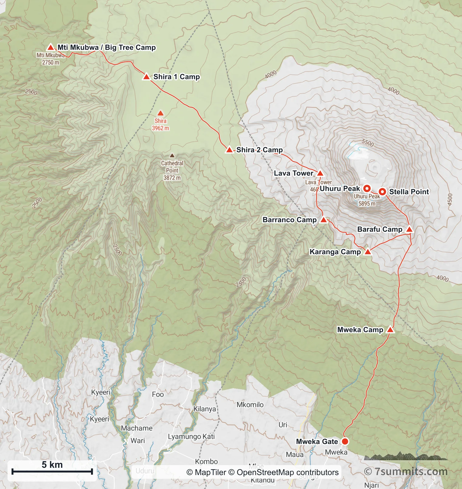
The Lemosho Route from the west across the Shira plateau to Uhuru Peak, descending by Mweka. Navigation aid only, not for wayfinding. · © MapTiler © OpenStreetMap contributors The Lemosho Route. The long approach across the Shira plateau before the mountain proper is what the extra days buy, and it is why this route acclimatizes better than the shorter ones. · Elevation data © Copernicus DEM (GLO-30) · peak names © OpenStreetMap contributors Read the chapter: The Lemosho route
The Umbwe route Point at the route or drag along the profile to see the height and the distance walked.
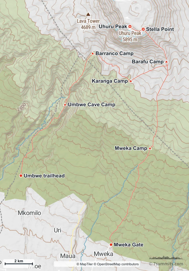
The Umbwe Route (the steepest and most direct way onto the mountain) to Uhuru Peak, descending by Mweka. Navigation aid only, not for wayfinding. · © MapTiler © OpenStreetMap contributors The Umbwe Route. The near-straight climb from the trailhead to Barranco is the steepest ground on any Kilimanjaro route, and this view is where that reads as a wall rather than as a shorter line on a map. · Elevation data © Copernicus DEM (GLO-30) · peak names © OpenStreetMap contributors Read the chapter: The Umbwe route
The Marangu route Point at the route or drag along the profile to see the height and the distance walked.
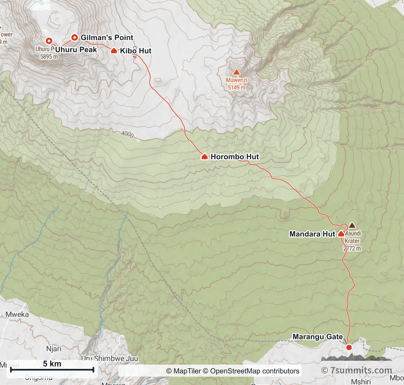
The Marangu Route from Marangu Gate to Uhuru Peak by Gilman’s Point: the only route that descends the way it came. Navigation aid only, not for wayfinding. · © MapTiler © OpenStreetMap contributors The Marangu Route, seen from the south-east. It climbs and descends the same line (the only route on the mountain that does) which is what makes it the shortest and the least acclimatizing. · Elevation data © Copernicus DEM (GLO-30) · peak names © OpenStreetMap contributors Read the chapter: The Marangu route
The Rongai route Point at the route or drag along the profile to see the height and the distance walked.
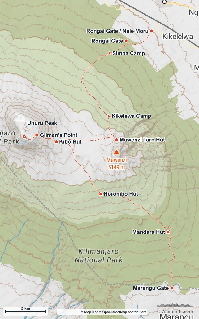
The Rongai Route from the north-east, the drier side of the mountain, past Mawenzi Tarn to Uhuru Peak. Navigation aid only, not for wayfinding. · © MapTiler © OpenStreetMap contributors The Rongai Route, from the north-east. It passes the foot of Mawenzi and crosses the saddle between the two cones: the only route that shows how far apart Kilimanjaro’s two summits really are. · Elevation data © Copernicus DEM (GLO-30) · peak names © OpenStreetMap contributors Read the chapter: The Rongai route
The Northern Circuit Point at the route or drag along the profile to see the height and the distance walked.
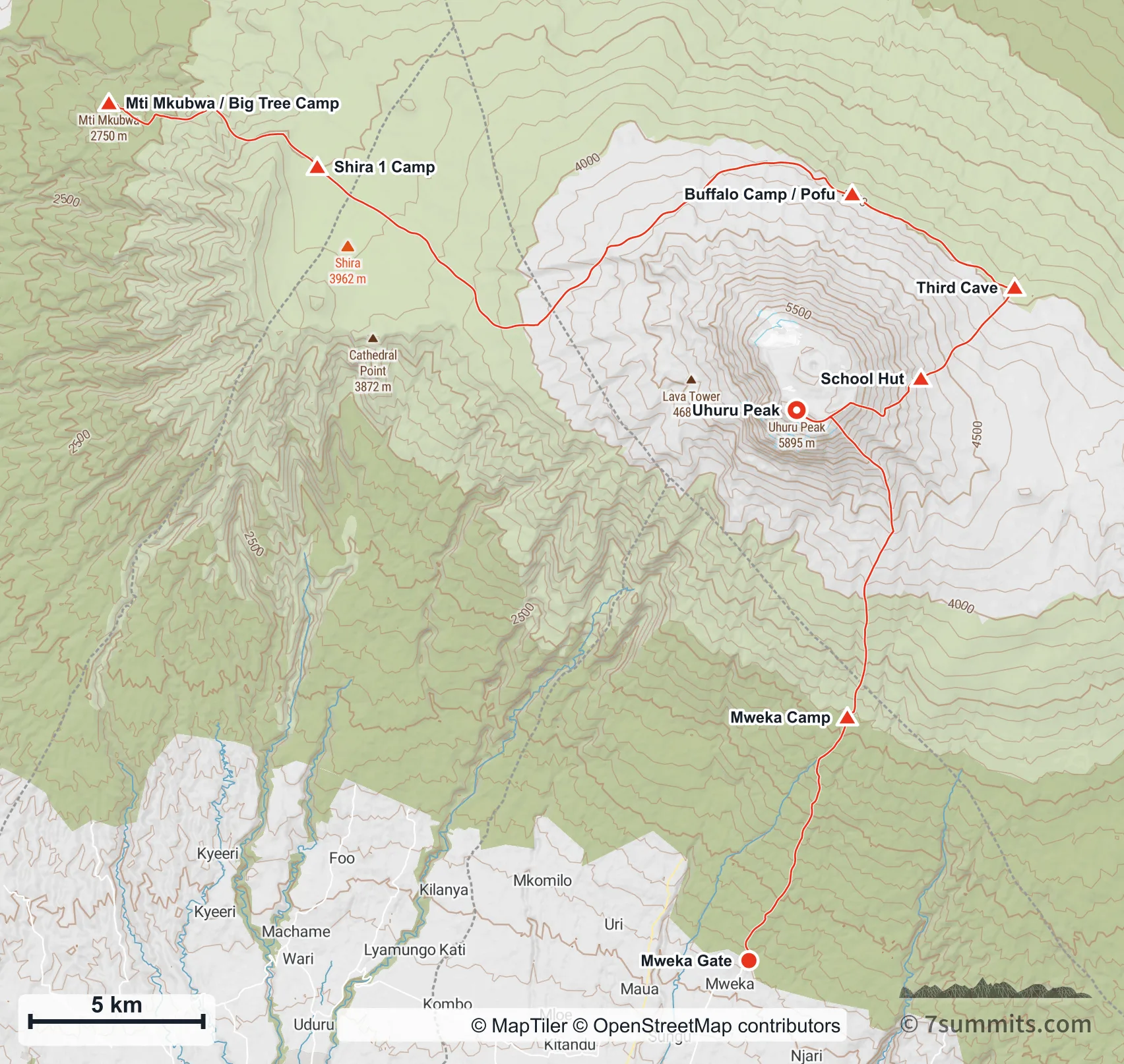
The Northern Circuit: the longest route on the mountain, round the northern slopes to Uhuru Peak and down by Mweka. Navigation aid only, not for wayfinding. · © MapTiler © OpenStreetMap contributors The Northern Circuit, seen from above because no view from the side can hold it: it is the only route that goes most of the way round the mountain. Contours are every 200 m. · Elevation data © Copernicus DEM (GLO-30) · peak names © OpenStreetMap contributors Read the chapter: The Northern Circuit
Mount Meru Point at the route or drag along the profile to see the height and the distance walked.
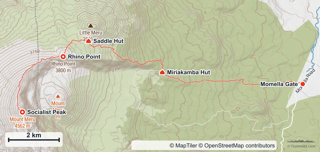
The Momella Route up Mount Meru: west through the game park to Miriakamba, up to Saddle Hut, then along the horseshoe crater rim to Socialist Peak. It is walked back down the way it came. Navigation aid only, not for wayfinding. · © MapTiler © OpenStreetMap contributors Mount Meru from the east, looking into the horseshoe crater. This is what makes the climb unusual: from Saddle Hut the summit day does not go straight up but follows the rim round the open side, over Rhino Point and along the curving wall to Socialist Peak, with the ash cone rising from the crater floor below. · Elevation data © Copernicus DEM (GLO-30) · peak names © OpenStreetMap contributors Read the chapter: Mount Meru
Day 2: Miriakamba Hut to Saddle Hut Point at the route or drag along the profile to see the height and the distance walked.
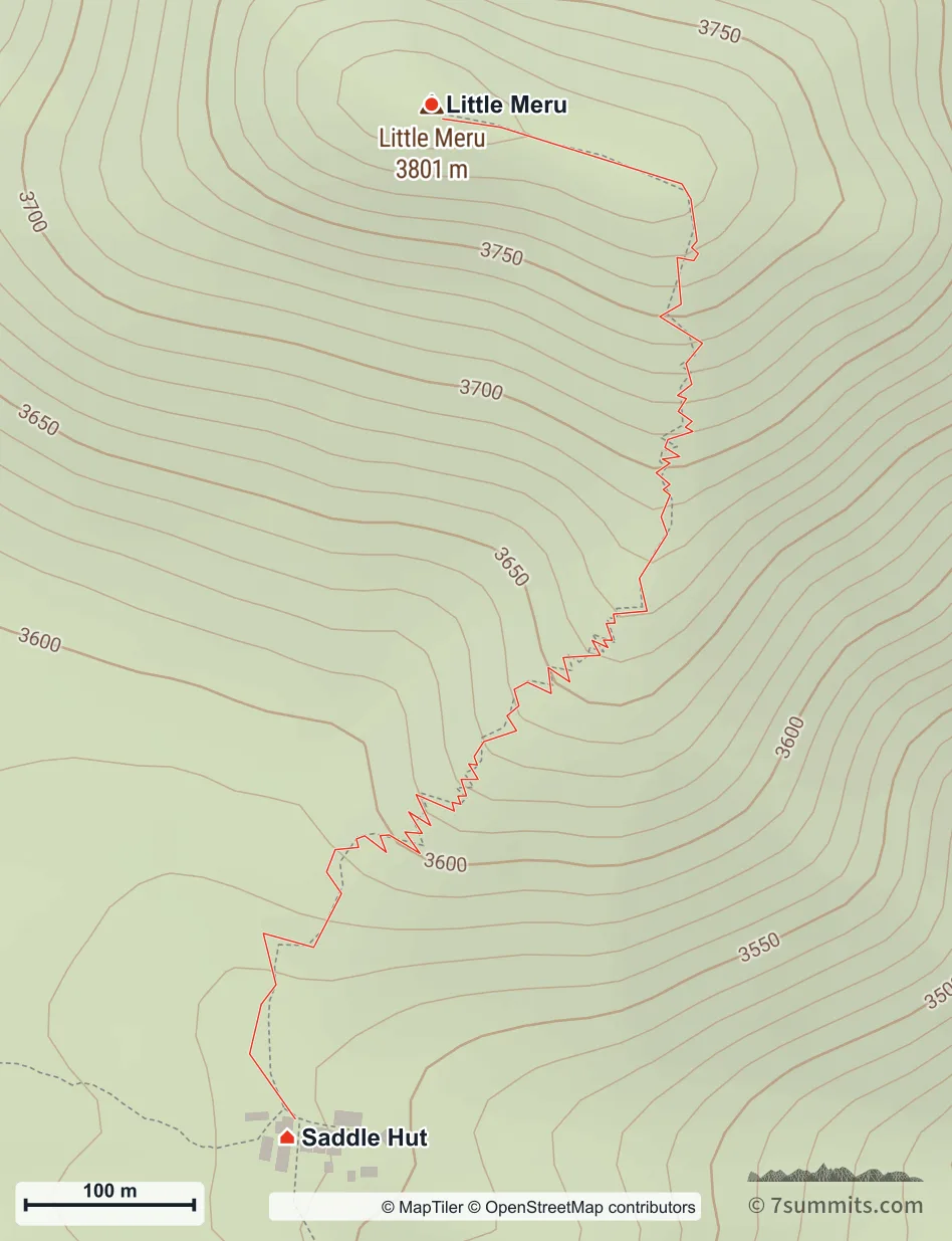
The Little Meru side hike, about 1.2 km and 240 m of climbing from Saddle Hut, walked back down the same way. Navigation aid only, not for wayfinding. · © MapTiler © OpenStreetMap contributors Read the chapter: Day 2: Miriakamba Hut to Saddle Hut
Using these maps 7summits.com draws these maps from GPS tracks and open elevation data, and each one carries the credit its sources ask for. To use one in print or on another site, ask us first. Get in touch