








The Umbwe route
The steepest and most direct way up, short, hard and quiet, joining the southern circuit at Barranco. For fit, experienced trekkers, ideally with extra acclimatization days built in.
Umbwe is the steepest and most direct route up Kilimanjaro, and the quietest of the popular southern approaches. It goes almost straight up a forested ridge on the mountain’s southern side, gaining height fast, before joining the southern circuit at Barranco. It is a beautiful, wild trail and you will see very few other people on its lower stages, but it is genuinely hard, and its directness is also its weakness.
This section describes only Umbwe’s own two lower stages, the steep climb from Umbwe Gate up to Umbwe Cave Camp, and on to Barranco. From Barranco, Umbwe follows exactly the same trail as Machame: the Barranco Wall, Karanga, Barafu, the summit via Stella Point and the descent via Mweka. Those shared stages are described on the Machame pages and this route links across to them.
Be honest with yourself about Umbwe. Because it climbs so fast and so high in its first two days, it gives you far less time to acclimatize than Machame or Lemosho, and taken at its bare minimum length it has a lower success rate to match. We would only recommend it to fit, experienced trekkers, and we would build in extra days (an acclimatization night at Barranco, and splitting the southern-circuit stages as Machame does) to give the mountain the time it demands. Short does not mean easy here; it means less margin.
In this section
Maps & profiles
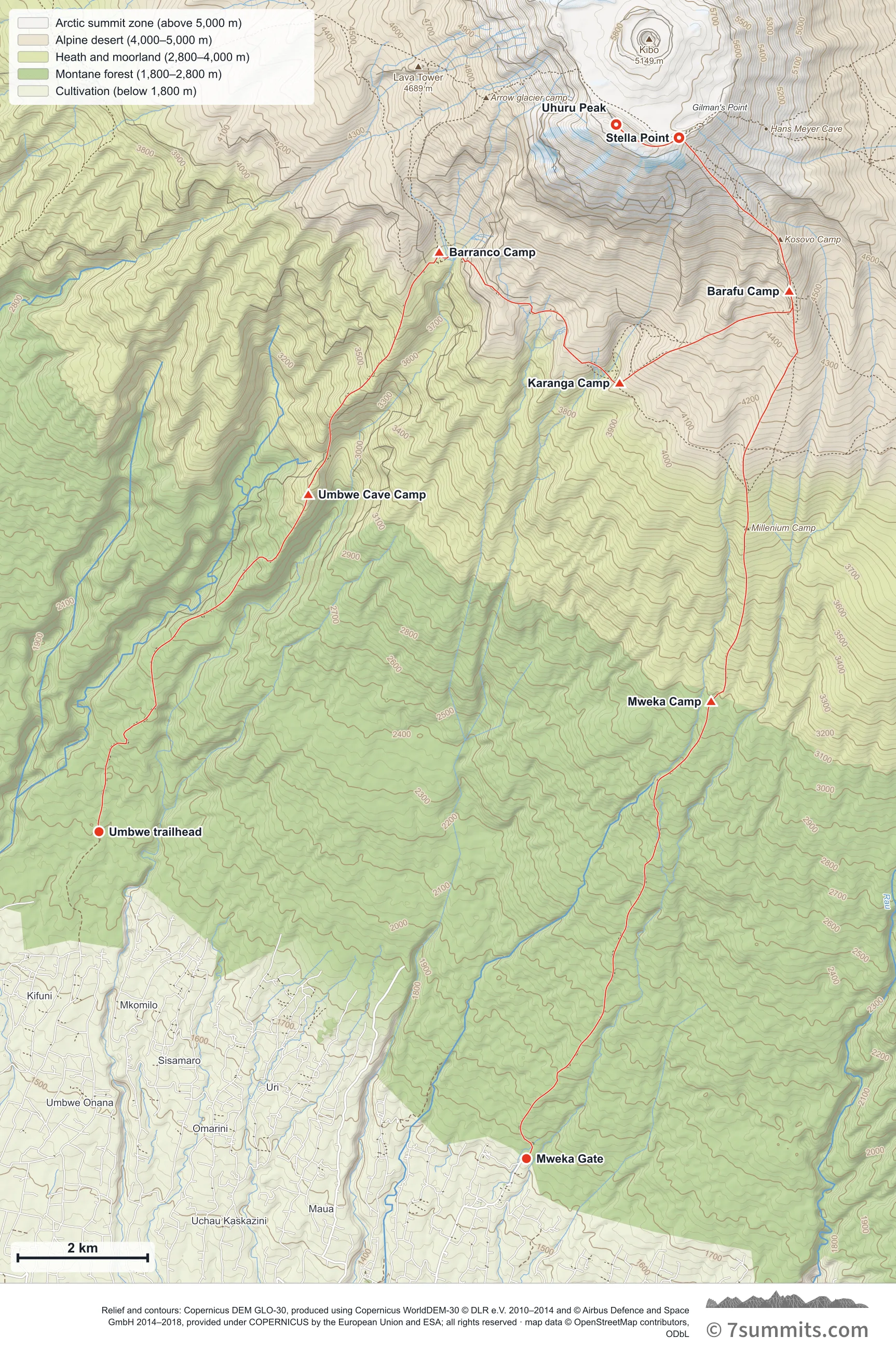
Point at the route or drag along the profile to see the height and the distance walked.
GPX files
Download the Umbwe Route track
Navigation aid only, not a substitute for your own judgement, current conditions or local knowledge. Elevations are modelled from open terrain data, not surveyed.
Sources, credits and licence
© OpenStreetMap contributors (ODbL). Licence: See source. Source data
Waypoints
WGS84 decimal degrees. Elevations are modelled from open terrain data (roughly 20–50 m low on snow and ice), not published camp altitudes: read them as approximate positions, not pitches.
| Waypoint | Latitude | Longitude | m | ft |
|---|---|---|---|---|
| Umbwe trailhead (5,889 ft) | -3.17430 | 37.28230 | 1,795 | 5,889 |
| Umbwe Cave Camp (9,350 ft) | -3.12761 | 37.31132 | 2,850 | 9,350 |
| Barranco Camp (13,025 ft) | -3.09407 | 37.32947 | 3,970 | 13,025 |
| Karanga Camp (13,107 ft) | -3.11218 | 37.35448 | 3,995 | 13,107 |
| Barafu Camp (15,331 ft) | -3.09947 | 37.37800 | 4,673 | 15,331 |
| Stella Point (18,885 ft) | -3.07824 | 37.36271 | 5,756 | 18,885 |
| Uhuru Peak (19,341 ft) | -3.07641 | 37.35400 | 5,895 | 19,341 |
| Mweka Camp (10,171 ft) | -3.15626 | 37.36717 | 3,100 | 10,171 |
| Mweka Gate (5,381 ft) | -3.21954 | 37.34156 | 1,640 | 5,381 |
Links to other people’s recordings, hosted by them. Compare and cross-check: never assume any single line is safe.