








Day 2: Miriakamba Hut to Saddle Hut
A steep climb of 3 to 5 hours to Saddle Hut at about 3,570 m, then the afternoon acclimatization hike up Little Meru at about 3,801 m.
| Time | 3–5 hours to Saddle Hut, plus an afternoon hike up Little Meru |
| Altitude gained | about 1,055 m3,461 ft: Miriakamba ~2,514 m8,248 ft → Saddle Hut ~3,570 m11,713 ft (then Little Meru ~3,801 m12,470 ft and back) |
| Grade | a short but steep and sustained climb |
| Terrain | steep forest and giant heather, up onto the saddle |
| Summary | a steep climb to Saddle Hut, then the key acclimatization hike up Little Meru |
The second day is short but steep, a sustained climb up through forest that gives way to a zone of giant heather, with the crater walls and the ash cone dramatic across the valley. It is real uphill work, and you feel the height as you gain it, but it does not take long.
Saddle Hut and Little Meru
You reach Saddle Hut at about 3,570 m11,713 ft, on the saddle between the main summit and the smaller peak of Little Meru, in time for lunch. The afternoon is the whole point of taking four days: after a rest you make the short climb up Little Meru, at about 3,801 m12,470 ft, for superb views (the summit ridge you will climb tonight, the ash cone below, and Kilimanjaro on the horizon) before dropping back to sleep at the Saddle. Climbing to 3,801 m12,470 ft and sleeping at 3,570 m11,713 ft is textbook walk-high-sleep-low, and it sets you up for the summit and, beyond it, for Kilimanjaro. Get to bed early: the summit start is not far off.
Maps & profiles
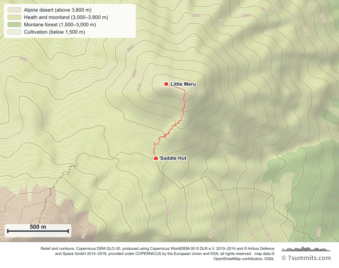
Point at the route or drag along the profile to see the height and the distance walked.
GPX files
Download the Little Meru side hike
Navigation aid only, not a substitute for your own judgement, current conditions or local knowledge. Elevations are modelled from open terrain data, not surveyed.
Sources, credits and licence
Derived from public recorded GPS tracks: jisna jb, "Mt Meru, Tanzania (Full Loop)" — the side hike from Saddle Hut, 17 July 2023 — wikiloc.com/…/mt-meru-tanzania-140966891. Elevation data © Mapzen Terrain Tiles, sourced from USGS, NASA SRTM/ASTER and NOAA.. Licence: Derived work — sources credited individually. Source data
Waypoints
WGS84 decimal degrees. Elevations are modelled from open terrain data (roughly 20–50 m low on snow and ice), not published camp altitudes: read them as approximate positions, not pitches.
| Waypoint | Latitude | Longitude | m | ft |
|---|---|---|---|---|
| Saddle Hut (3,570 m) | -3.21810 | 36.77332 | 3,570 | 11,713 |
| Little Meru (3,801 m) | -3.21259 | 36.77409 | 3,801 | 12,470 |
Links to other people’s recordings, hosted by them. Compare and cross-check: never assume any single line is safe.