








The longer, quieter route with no chairlift: from Charlotte Pass along the closed old Summit Road past Seaman's Hut and Rawson Pass to the top, about 18.6 km return.
| Time | 6–8 hours return |
| Distance | ~18.6 km return from Charlotte Pass |
| Altitude gained | ~390 m1,280 ft net, from Charlotte Pass (~1,835 m6,020 ft) to the summit (2,228 m7,310 ft), with undulation |
| Grade | Easy to moderate walking on a wide, formed old road; long but not technical |
| Terrain | The closed Summit Road (a wide gravel vehicle track) across open alpine country; fully exposed |
| Summary | A longer, quieter day than Thredbo, on foot the whole way up the historic Summit Road. |
From Charlotte Pass the route to the summit follows the old Summit Road, a wide gravel road that was once open to cars but has long been closed to traffic and left as a walking route. Note that parts of the park, including walking tracks and huts, will be closed on weekdays from 5:45am to 8:15pm between 9 and 27 November 2026 for feral deer and pig control, so check the NPWS closure map before travelling (see our note on the closures). There is no chairlift here (you walk every metre) which makes for a longer day than Thredbo, about 18.6 km there and back, but a quieter and in some ways more satisfying one.
The Summit Road
The going is genuinely easy underfoot: it is a road, after all, wide and well graded, winding up and along the flank of the range. What you get for the extra distance is space and quiet (this side sees fewer people than the Thredbo walkway) and a proper sense of walking up into the high country under your own steam. The road crosses open herbfields with big views out over the Snowy Mountains.
Seaman's Hut
A little over halfway you pass Seaman's Hut, a sturdy stone refuge built in memory of a walker who died in a blizzard nearby, a reminder, on the calmest summer day, of how quickly this exposed country can turn. The hut is kept as an emergency shelter and has saved lives; treat it with respect and leave it as you found it. It is described further under the mountain and the Main Range.
Seamans Hut, dwarfed by the ridge above, in winter snow.
Rawson Pass and the summit
The road climbs to Rawson Pass, where it meets the Thredbo track, and from there you join everyone else for the final 1.4 km loop to the top at 2,228 m7,310 ft. Return the way you came. Because there is no lift to catch, this route is a little more forgiving on timing than Thredbo, but it is longer, so start early and keep an eye on the weather over the exposed miles.
Maps & profiles
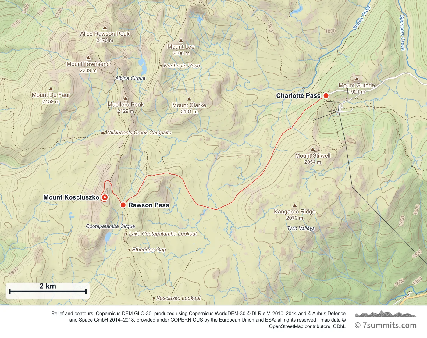
Point at the route or drag along the profile to see the height and the distance walked.
GPX files
Download the Charlotte Pass track
Navigation aid only, not a substitute for your own judgement, current conditions or local knowledge. Elevations are modelled from open terrain data, not surveyed.
Sources, credits and licence
© OpenStreetMap contributors + OSM public GPS traces. Licence: ODbL 1.0. Source data
Waypoints
WGS84 decimal degrees. Elevations are modelled from open terrain data (roughly 20–50 m low on snow and ice), not published camp altitudes: read them as approximate positions, not pitches.
| Waypoint | Latitude | Longitude | m | ft |
|---|---|---|---|---|
| Charlotte Pass (6,037 ft) | -36.43181 | 148.32833 | 1,840 | 6,037 |
| Rawson Pass (6,969 ft) | -36.45759 | 148.26885 | 2,124 | 6,969 |
| Mount Kosciuszko (7,310 ft) | -36.45580 | 148.26350 | 2,228 | 7,310 |
Links to other people’s recordings, hosted by them. Compare and cross-check: never assume any single line is safe.