








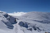

The finest and most exposed day on the mountain: a ~22 km circuit from Charlotte Pass past Blue Lake and the glacial lakes, over Carruthers Peak and the high tops to the summit, returning by the Summit Road.
| Time | 7–9 hours for the full circuit |
| Distance | ~22 km loop from Charlotte Pass |
| Altitude gained | ~750 m2,461 ft of cumulative climbing over the tops |
| Grade | Moderate; a long day on tracks with some rougher, exposed alpine sections |
| Terrain | Alpine track past glacial lakes and over open ridgelines, then the Summit Road; very exposed on the tops |
| Summary | The best-views route (the glacial lakes and the high Main Range) and the most serious in bad weather. |
The Main Range loop spends hours on completely exposed high ground with no shelter. It is a wonderful walk in good weather and a genuinely serious one in bad, this is where a summer storm or an early cold front bites hardest. Check the forecast, carry full weather protection, and be ready to turn back or cut it short. In winter it is a committing alpine ski-tour with cornice and whiteout risk, not a walk.
If you only do one walk on Kosciuszko and the weather is kind, make it this one. The Main Range loop from Charlotte Pass is the scenic classic of the whole range: it strings together the glacial lakes, the high ridgelines and the summit itself into a circuit of around 22 km, and the views are the best on the mountain. It is also the most exposed and the longest of the day-walks, so it asks for good conditions and a decent level of fitness.
Down to the lakes
From Charlotte Pass the track drops to cross the infant Snowy River and climbs onto the Main Range, traversing towards the glacial lakes. Blue Lake, set in its steep rock cirque, is the showpiece (deep, cold and startlingly blue) with Hedley Tarn below it and Club Lake and Lake Albina strung along the range. These are the only glacial lakes on mainland Australia, and walking among them is the heart of this route.
Over the high tops
The track climbs onto the crest and over the high tops, including Carruthers Peak, one of the best viewpoints on the range, looking across to Mount Townsend and down the western fall towards Geehi. This is open, rocky alpine walking with the ground falling away on both sides: magnificent, and fully exposed to whatever the weather is doing. You follow the tops around towards Rawson Pass.
Nothing is loaded from YouTube until you press play.
A two-day hike across the Main Range, taking in Kosciuszko, Townsend and Twynam with a high camp at Wilkinson's Creek: a clear sense of the ridgeline's exposure and the scale of this alpine plateau on foot.
To the summit and back by the road
From Rawson Pass the shared final 1.4 km takes you to the summit at 2,228 m7,310 ft. To close the loop you descend the Summit Road back to Charlotte Pass, an easy, gently descending walk after the high ground, passing Seaman's Hut on the way. Many walkers do the circuit this way round, saving the wide easy road for tired legs at the end; you can also reverse it. Either way it is a big, rewarding day.
Wind-scoured snow and exposed rock mark the final approach across the summit plateau.
Maps & profiles
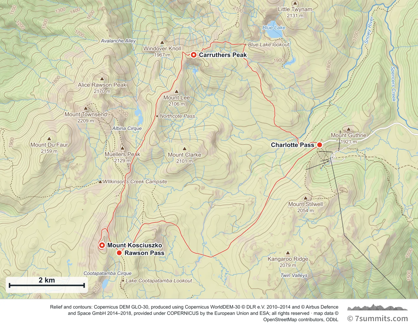
Point at the route or drag along the profile to see the height and the distance walked.
GPX files
Download the Main Range loop track
Navigation aid only, not a substitute for your own judgement, current conditions or local knowledge. Elevations are modelled from open terrain data, not surveyed.
Sources, credits and licence
© OpenStreetMap contributors (ODbL). Licence: See source. Source data
Waypoints
WGS84 decimal degrees. Elevations are modelled from open terrain data (roughly 20–50 m low on snow and ice), not published camp altitudes: read them as approximate positions, not pitches.
| Waypoint | Latitude | Longitude | m | ft |
|---|---|---|---|---|
| Charlotte Pass (6,027 ft) | -36.43167 | 148.32865 | 1,837 | 6,027 |
| Carruthers Peak (7,037 ft) | -36.40999 | 148.29095 | 2,145 | 7,037 |
| Mount Kosciuszko (7,310 ft) | -36.45583 | 148.26351 | 2,228 | 7,310 |
| Rawson Pass (6,969 ft) | -36.45767 | 148.26866 | 2,124 | 6,969 |
Links to other people’s recordings, hosted by them. Compare and cross-check: never assume any single line is safe.