








The biggest single ascent of any walk in Australia, over 1,800 m up the western Geehi side of the range. A remote, steep, historic two-day route for experienced walkers, described in two stages.
Hannels Spur is the outlier among the Kosciuszko routes, and the one that earns the word "climb". It rises from the Geehi valley on the western side of the range (the low, hot country far below the summit) straight up the mountain's western fall to the top. The vertical gain, over 1,800 m5,906 ft from valley to summit, is the largest of any walk in Australia, and it is done through wild, remote, faintly-tracked country over two days. This is not a day-walk that got long; it is a different kind of trip.
Why it matters
This is also the historic line. When Strzelecki made the first recorded ascent in 1840, he came up from this western side, through the Geehi country. Walking Hannels Spur is, in a real sense, retracing the original route to the top of Australia, up the hard way, the way the graziers and the first climbers knew it.
What you are taking on
Everything about this route is more serious than the summit walks. It is long and unrelentingly steep on the climb; the track is faint, overgrown and hard to follow in places, and stretches of it have been affected by bushfire, leaving deadfall and regrowth to push through, so check the current condition before you go. There is no chairlift, no road, no shelter and, for most of it, no phone coverage. You need to be a fit, experienced, self-reliant walker, carry everything for an overnight camp, and be confident with navigation. Done well, in Harry's words, it is a fun climb, a proper mountain adventure on a mountain most people stroll up. Done casually, it is a route to get into trouble on.
The two stages
The route is described here in two days: the big climb from Geehi up the spur to a camp near the top of the timber, and then the second day up onto the tops to the summit and out. Read both before you commit, and treat the timings as a fit party's in good conditions.
Maps & profiles
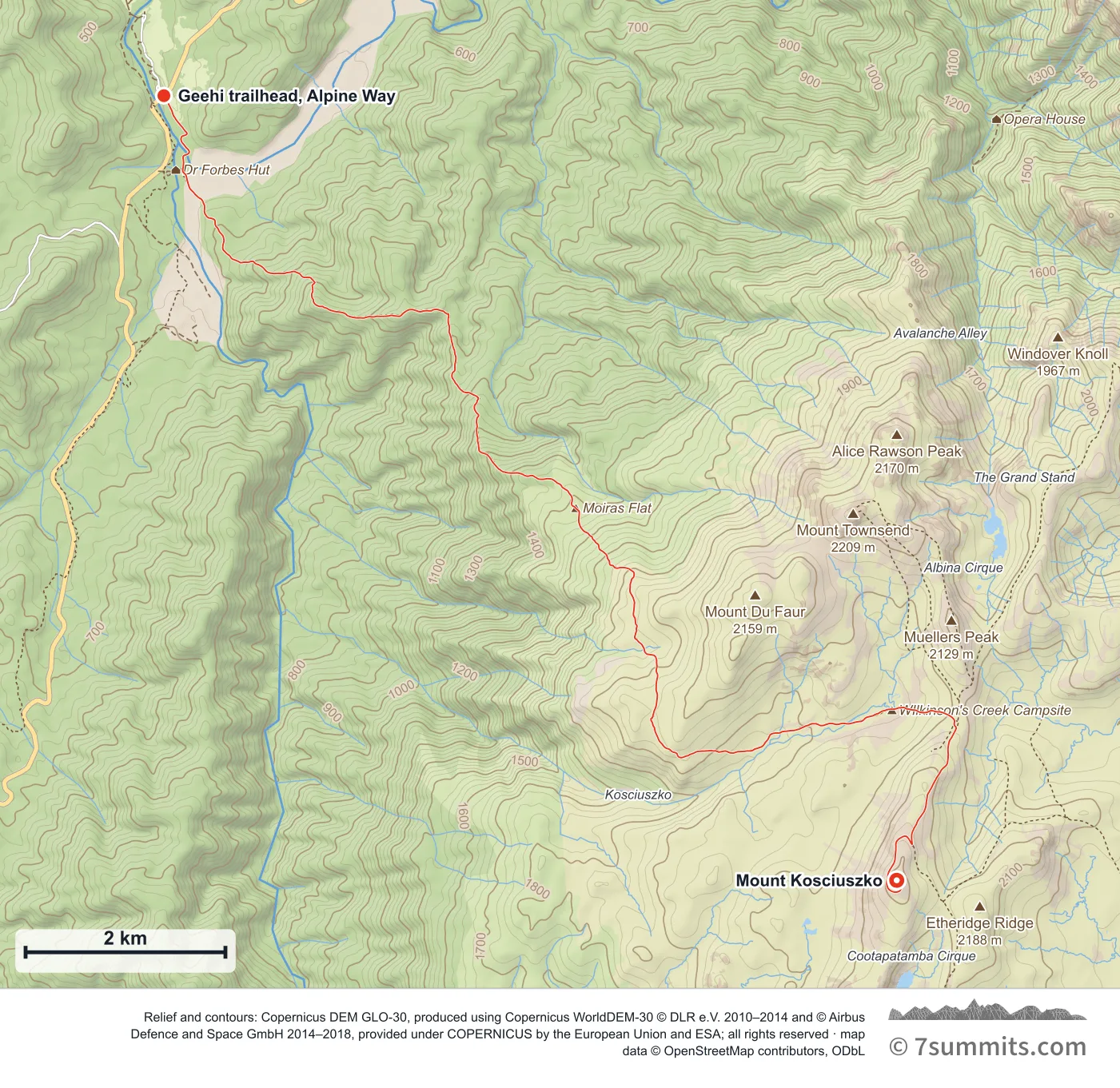
Point at the route or drag along the profile to see the height and the distance walked.
GPX files
Download the Hannels Spur track
Navigation aid only, not a substitute for your own judgement, current conditions or local knowledge. Elevations are modelled from open terrain data, not surveyed.
Sources, credits and licence
Route geometry © OpenStreetMap contributors (ODbL). Trailhead and summit sections derived from a public recorded GPS track: Robyn Robertson, verified Fastest Known Time, 3 May 2025 (recorded GPS track published on fastestknowntime.com). Elevation data © Mapzen Terrain Tiles, sourced from USGS, NASA SRTM/ASTER and NOAA.. Licence: ODbL 1.0. Source data
Waypoints
WGS84 decimal degrees. Elevations are modelled from open terrain data (roughly 20–50 m low on snow and ice), not published camp altitudes: read them as approximate positions, not pitches.
| Waypoint | Latitude | Longitude | m | ft |
|---|---|---|---|---|
| Geehi trailhead, Alpine Way (436 m) | -36.38526 | 148.18163 | 425 | 1,394 |
| Moira's Flat camp (1,520 m) | -36.42237 | 148.22767 | 1,520 | 4,987 |
| Mount Kosciuszko (2,228 m) | -36.45580 | 148.26350 | 2,228 | 7,310 |
Links to other people’s recordings, hosted by them. Compare and cross-check: never assume any single line is safe.